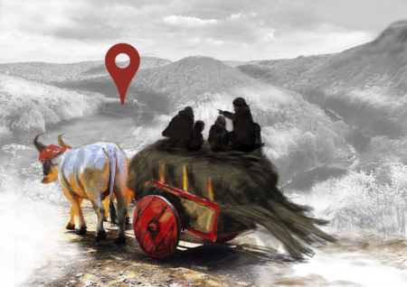
26th of February to the 1st of March 2024, Port-Louis, Brittany, France After a first super succesful session in May 2023, from which we developed a package for radial analysis with the team of Rouen (UMR Idees), Port-Louis (Morbihan, France) will welcome our 2nd coding retreat from February 26th to March 1st. The retreat is
CategoryQuadtrees
Quadtrees Hub#8
The internal scaling of pollution and congestion of European cities 2 presentations by Yufei Wei and by Estelle Mennicken When? 18th June 2021, 14:00-16:00 Where? Webex The Quadtrees Hubs are to share opinions and discuss research in progress. The meetings of Quadtrees Hubs are open to anyone interested and somehow familiar with some quantitative techniques and
Quadtrees Hub#7
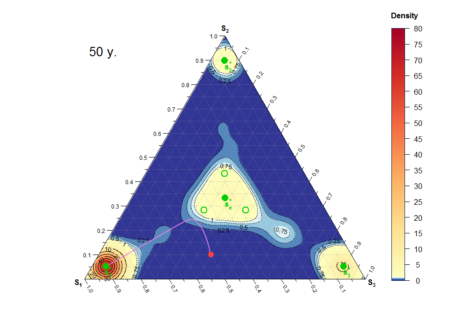
Using point process models for comparing archaeological settlement patterns Kaarel Sikk (University of Luxembourg, C2DH and DGEO) When? 21st May 2021, 2 to 3 pm Where? via Webex (request meeting link by registering to isabelle.piroth@uni.lu or geoffrey.caruso@uni.lu) Point process modelling provides a framework for exploring systems that can be observed as a set of points.
Quadtrees Hub#6
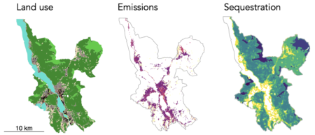
Towards a spatially explicit urban CO2 budget. Urban carbon emissions, dispersion and sequestration in Europe On May 21st, our sixth Quadtrees Hub will take place. The aim is to share and discuss research in progress. Quadtrees’hubs are open to anyone interested and somehow familiar with some quantitative techniques and willing to progress with these. Please
Quadtrees Hub#5
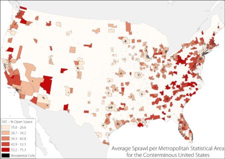
Portraying Urban Sprawl from Space: an update and geographical effects On March 10th (NEW DATE), our fifth Quadtrees Hub will take place. The aim is to share and discuss research in progress. Quadtrees’hubs are open to anyone interested and somehow familiar with some quantitative techniques and willing to progress with these. Please contact Isabelle Pigeron-Piroth
Quadtrees Hub#4
Tuesday 21st of January, our fourth Quadtrees Hub will take place. The aim is to share and discuss research in progress. Quadtrees’hubs are open to anyone interested and somehow familiar with some quantitative techniques and willing to progress with these. Please contact Isabelle Pigeron-Piroth for information. When? 21st of January 2019 14h-16h. Where? Map Room
Quadtrees Hub#3
Tuesday 17th of December, our third Quadtrees Hub will take place – to discuss ongoing research in quantitative methods, urban analytics and spatial data from both the Urban Development and Mobility Dpt of LISER and the Dpt of Geography and Spatial Planning at the University of Luxembourg. The aim is to share and discuss research
Quadtrees Hub#1
Tue 22nd 2PM, we launch a new series of internal workshop – Quadtrees Hubs– to discuss ongoing research in quantitative methods, urban analytics and spatial data from both the Urban Development and Mobility Dpt of LISER and the Dpt of Geography and Spatial Planning at the University of Luxembourg. The aim is to share and

