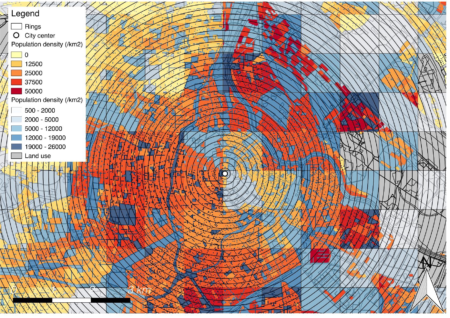
PhD candidate: Marlène BouraSupervision: Geoffrey CarusoDuration: 2017-2021 In the context of population growth and urbanisation, associated with an increase of GHG concentration in the atmosphere, the impact of human activities on climate change is ever increasing. Simultaneously, the pressure on natural ecosystems especially within and around cities becomes harder. We contend that these natural ecosystems
Quadtrees Hub#5
Portraying Urban Sprawl from Space: an update and geographical effects On March 10th (NEW DATE), our fifth Quadtrees Hub will take place. The aim is to share and discuss research in progress. Quadtrees’hubs are open to anyone interested and somehow familiar with some quantitative techniques and willing to progress with these. Please contact Isabelle Pigeron-Piroth
Quadtrees Hub#4
Tuesday 21st of January, our fourth Quadtrees Hub will take place. The aim is to share and discuss research in progress. Quadtrees’hubs are open to anyone interested and somehow familiar with some quantitative techniques and willing to progress with these. Please contact Isabelle Pigeron-Piroth for information. When? 21st of January 2019 14h-16h. Where? Map Room
Quadtrees Hub#3
Tuesday 17th of December, our third Quadtrees Hub will take place – to discuss ongoing research in quantitative methods, urban analytics and spatial data from both the Urban Development and Mobility Dpt of LISER and the Dpt of Geography and Spatial Planning at the University of Luxembourg. The aim is to share and discuss research
Quadtrees Hub#2
Tuesday 12th of November 2PM, our second Quadtrees Hub will take place – to discuss ongoing research in quantitative methods, urban analytics and spatial data from both the Urban Development and Mobility Dpt of LISER and the Dpt of Geography and Spatial Planning at the University of Luxembourg. The aim is to share and discuss
Festival of Maps
The Institute of Geography and Spatial Planning welcomes you to the Festival of Maps, as part of the Science Festival at the Neumünster Abbey from 7 to 10 November. We have in store a fantastic range of activities where kids and the general public will discover how geographical information gets transformed into maps. During the
Quadtrees Hub#1
Tue 22nd 2PM, we launch a new series of internal workshop – Quadtrees Hubs– to discuss ongoing research in quantitative methods, urban analytics and spatial data from both the Urban Development and Mobility Dpt of LISER and the Dpt of Geography and Spatial Planning at the University of Luxembourg. The aim is to share and
Activity spaces in place and health research: Novel exposure measures, data collection tools, and designs
So excited to see our paper on “Activity spaces in place and health research” published in Health and Place, with Basile Chaix and Yan Kestens : https://doi.org/10.1016/j.healthplace.2019.05.008 Free access until October 9th, 2019: https://authors.elsevier.com/a/1ZbT5_Uo5A~6R5 Our commentary answers a systematic review from Lindsey Smith, Louise Foley and Jenna Panther on “Activity spaces in studies of the environment
When motility and movement meet wellbeing
Check out our new CURHA (Contrasting Urban Environments and Healthy Ageing, FNR-IRSC-FRSQ project) paper on links between mobility and wellbeing among older adults in Luxembourg ! We used the concept of motility, estimated in a structural equation model, in order to disentangle the complex relationships between locations, geographic environments and daily mobility related to wellbeing.

